Geolocate

Courchon topographic map

Click on the map to display elevation.

About this map
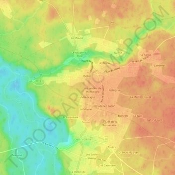
Name: Courchon topographic map, elevation, terrain.

Location: Courchon, Belin-Béliet, Arcachon, Gironde, Nouvelle-Aquitaine, France métropolitaine, 33830, France (44.48482 -0.80938 44.52482 -0.76938)

Average elevation: 40 m

Minimum elevation: 10 m

Maximum elevation: 57 m

Other topographic maps

Click on a map to view its topography, its elevation and its terrain.

33830

France > Nouvelle-Aquitaine > Gironde > Belin-Béliet

Average elevation: 49 m

Gear up for your next adventure:

🧊Insulated Water Bottle - Keeps drinks cold in summer and prevents freezing in winter
🧤Insulated Winter Gloves - Heavy-duty protection for sub-zero Canadian adventures
🧴Insect Repellent - Protect yourself from bugs during outdoor adventures
🥾Trekking Poles - Adjustable trekking poles to reduce knee stress and improve stability
🧤Rechargeable Heated Gloves - Extreme warmth for Canadian winter expeditions

As an Amazon Associate, this site earns from qualifying purchases at no extra cost to you.