
Liarey topographic map
Interactive map
Click on the map to display elevation.
About this map
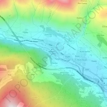
Name: Liarey topographic map, elevation, terrain.
Location: Liarey, Morgex, Vallée d'Aoste, 11017, Italie (45.73572 7.01495 45.77572 7.05495)
Average elevation: 1,286 m
Minimum elevation: 879 m
Maximum elevation: 2,164 m
Other topographic maps
Click on a map to view its topography, its elevation and its terrain.
Arpy
Italie > Vallée d'Aoste > Morgex
Arpy, Morgex, Vallée d'Aoste, 11017, Italie
Average elevation: 1,547 m