
Make a donation
Gear up for your next adventure:
As an Amazon Associate, this site earns from qualifying purchases at no extra cost to you.
Deutschhof topographic map
Click on the map to display elevation.
Make a donation
Gear up for your next adventure:
As an Amazon Associate, this site earns from qualifying purchases at no extra cost to you.
About this map
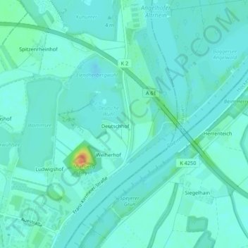
Name: Deutschhof topographic map, elevation, terrain.
Location: Deutschhof, Speyer, Rheinland-Pfalz, Deutschland (49.34233 8.45906 49.34326 8.46343)
Average elevation: 95 m
Minimum elevation: 88 m
Maximum elevation: 129 m
Make a donation
Gear up for your next adventure:
As an Amazon Associate, this site earns from qualifying purchases at no extra cost to you.
Other topographic maps
Click on a map to view its topography, its elevation and its terrain.
Speyer
Deutschland > Rheinland-Pfalz > Speyer
Das Stadtgebiet Speyers hat Anteil an der Rheinniederung (etwa 93 m über Normalnull), der Niederterrasse (im Mittel bei 103 m über Normalnull) und der Hochterrasse (bis zu 113 m über Normalnull). Die Rheinniederung besteht aus alluvialen und holozänen Ablagerungen. Die Niederterrasse entstand in der…
Average elevation: 101 m