Geolocate

Monkton topographic map

Click on the map to display elevation.

About this map

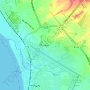
Name: Monkton topographic map, elevation, terrain.

Location: Monkton, South Ayrshire, Scotland, KA9 2RT, United Kingdom (55.49642 -4.62279 55.53642 -4.58279)

Average elevation: 20 m

Minimum elevation: -1 m

Maximum elevation: 78 m

Gear up for your next adventure:

🧴Sunscreen SPF - Broad-spectrum sunscreen for outdoor activities
👟Sport Hiking Sandals - Breathable footwear for water crossings and camp rest
🥾Waterproof Hiking Shoes - Durable shoes for wet and rugged trails
🧥Ultralight Puffy Jacket - Maximum warmth that packs down to the size of an orange
🧳Compression Sacks - Maximize space in your backpack by shrinking gear

As an Amazon Associate, this site earns from qualifying purchases at no extra cost to you.