Geolocate

Golden Crest topographic map

Click on the map to display elevation.

About this map
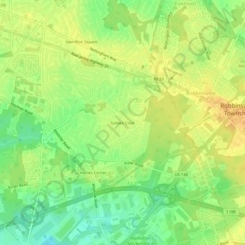
Name: Golden Crest topographic map, elevation, terrain.

Location: Golden Crest, Hamilton Township, Mercer County, New Jersey, 08690, United States (40.19407 -74.66441 40.23407 -74.62441)

Average elevation: 30 m

Minimum elevation: 10 m

Maximum elevation: 45 m

Other topographic maps

Click on a map to view its topography, its elevation and its terrain.

Gear up for your next adventure:

🧭GPS Outdoor Watch - Smart watch for navigation and fitness tracking in nature
👟Trail Running Shoes - Agile footwear for fast-paced topographic exploration
💡LED Headlamp - Hands-free illumination for night hiking and camping
🔦LED Flashlight - Powerful and long-lasting flashlight for camping and emergencies
🥫Freeze-Dried Meals - Lightweight, high-calorie nutrition for multi-day treks

As an Amazon Associate, this site earns from qualifying purchases at no extra cost to you.