Geolocate

Baratan topographic map

Click on the map to display elevation.

About this map

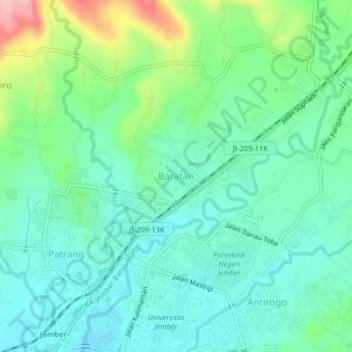
Name: Baratan topographic map, elevation, terrain.

Location: Baratan, Jember, East Java, Java, 68111, Indonesia (-8.15440 113.71030 -8.11440 113.75030)

Average elevation: 144 m

Minimum elevation: 91 m

Maximum elevation: 304 m

Other topographic maps

Click on a map to view its topography, its elevation and its terrain.

Watu Ulo

Indonesia > East Java > Jember > Watuulo

Average elevation: 9 m

Gear up for your next adventure:

🥾Waterproof Trail Shoes - Shoes designed to handle wet terrain
📷Outdoor Action Camera - Capture high-elevation views and rugged adventures
Camping Coffee Maker - Brew fresh coffee anywhere on the topographic map
🧰Emergency Multi-Tool - Compact multi-tool for outdoor survival
🦶Anti-Blister Balm - Prevents friction and hotspots during long ascents

As an Amazon Associate, this site earns from qualifying purchases at no extra cost to you.