Geolocate

Lautertal topographic map

Click on the map to display elevation.

About this map

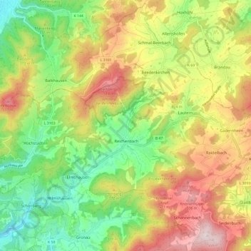
Name: Lautertal topographic map, elevation, terrain.

Location: Lautertal, Kreis Bergstraße, Hesse, 64686, Germany (49.68039 8.65570 49.75497 8.77464)

Average elevation: 339 m

Minimum elevation: 144 m

Maximum elevation: 582 m

Gear up for your next adventure:

🧦Crew Hiking Socks - Comfortable socks for long-distance hikes
🧦Outdoor Socks - Durable socks designed for hiking and outdoor sports
🧥Thermal Fleece Jacket - Versatile insulation for changing mountain temperatures
💧Reusable Water Bottle - Durable water bottles for hydration on trails
🥾Approach Shoes - Shoes designed for climbing approaches and rugged trails

As an Amazon Associate, this site earns from qualifying purchases at no extra cost to you.