Geolocate

Newland topographic map

Click on the map to display elevation.

Newland

Newland is a town in Avery County, North Carolina, United States. The population was 698 at the 2010 census. It is the county seat of Avery County. It is the highest, by elevation, county seat east of the Mississippi River.

Wikipedia (CC-BY-SA 3.0)

About this map

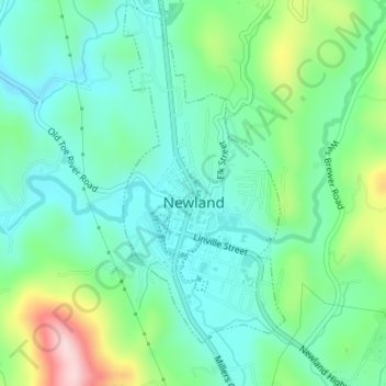
Name: Newland topographic map, elevation, terrain.

Location: Newland, Avery County, North Carolina, United States (36.07748 -81.93346 36.10475 -81.91943)

Average elevation: 1,140 m

Minimum elevation: 1,074 m

Maximum elevation: 1,321 m

Gear up for your next adventure:

🎒Hiking Daypack - Lightweight and durable backpacks for day trips and excursions
🥾All-Terrain Hiking Boots - Versatile boots for varied hiking conditions
🦌Outdoor Trail Camera - Monitor wildlife activity near your favorite spots
🩹Compact First Aid Kit - Pre-packed essentials for common trail injuries
🐕Hiking Dog Pack - Let your canine companion carry their own water and food

As an Amazon Associate, this site earns from qualifying purchases at no extra cost to you.