Geolocate

paddar topographic map

Click on the map to display elevation.

About this map

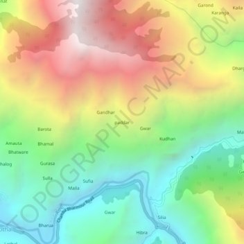
Name: paddar topographic map, elevation, terrain.

Location: paddar, Chamba, Chamba District, Himachal Pradesh, India (32.47209 76.29734 32.51209 76.33734)

Average elevation: 2,030 m

Minimum elevation: 1,187 m

Maximum elevation: 3,157 m

Gear up for your next adventure:

🥾Waterproof Hiking Boots - Essential footwear for rugged terrain and wet Canadian trails
🧦Crew Hiking Socks - Comfortable socks for long-distance hikes
🧥Packable Rain Jacket - Breathable waterproof layer for unpredictable weather
🔭Compact Binoculars - Lightweight optics for scouting trails and wildlife
🔨Vehicle Emergency Tool - Safety tool for remote road trips to trailheads

As an Amazon Associate, this site earns from qualifying purchases at no extra cost to you.