Geolocate

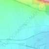
Santa Catarina topographic map

Click on the map to display elevation.

About this map

Name: Santa Catarina topographic map, elevation, terrain.

Location: Santa Catarina, Nuevo León, Mexico (25.41353 -100.72979 25.75004 -100.23872)

Average elevation: 1,496 m

Minimum elevation: 435 m

Maximum elevation: 3,704 m

Other topographic maps

Click on a map to view its topography, its elevation and its terrain.

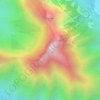
El Jonuco

Mexico > Nuevo León > Santa Catarina

Average elevation: 1,974 m

El Fraile

Mexico > Nuevo León > García

Average elevation: 695 m

aaaaaaaaaaa

Mexico > Nuevo León > Monterrey

Average elevation: 701 m

La Lobita

Mexico > Nuevo León > Juárez > La Lobita

Average elevation: 440 m

San Miguel

Mexico > Nuevo León > García

Average elevation: 1,431 m

Allende

Mexico > Nuevo León > Allende

Average elevation: 466 m

Gear up for your next adventure:

🧦Merino Wool Socks - Moisture-wicking comfort for long-distance hiking
🥾Mountain Hiking Shoes - Shoes with superior grip for mountainous terrain
🪑Insulated Seat Pad - Protect your seat from cold rocks and wet logs
🧥Softshell Jacket - Windproof and breathable jacket for hiking
🧴Insect Repellent - Protect yourself from bugs during outdoor adventures

As an Amazon Associate, this site earns from qualifying purchases at no extra cost to you.