
Voerendaal topographic map
Interactive map
Click on the map to display elevation.
About this map
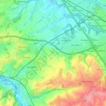
Name: Voerendaal topographic map, elevation, terrain.
Location: Voerendaal, Limburg, Niederlande (50.83966 5.86149 50.90484 5.96936)
Average elevation: 124 m
Minimum elevation: 74 m
Maximum elevation: 217 m