Geolocate

Bandungan topographic map

Click on the map to display elevation.

About this map
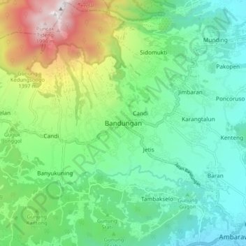
Name: Bandungan topographic map, elevation, terrain.

Location: Bandungan, Kabupaten Semarang, Central Java, 50665, Indonesia (-7.26284 110.32754 -7.18284 110.40754)

Average elevation: 920 m

Minimum elevation: 481 m

Maximum elevation: 2,006 m

Other topographic maps

Click on a map to view its topography, its elevation and its terrain.

Gear up for your next adventure:

🧭GPS Outdoor Watch - Smart watch for navigation and fitness tracking in nature
🛁Quick-Dry Microfiber Towel - Space-saving towel that dries rapidly on the move
🧊Insulated Water Bottle - Keeps drinks cold in summer and prevents freezing in winter
🧥Softshell Jacket - Windproof and breathable jacket for hiking
🥾Durable Hiking Shoes - Long-lasting shoes for frequent hiking

As an Amazon Associate, this site earns from qualifying purchases at no extra cost to you.