
Noresund topographic map
Interactive map
Click on the map to display elevation.
About this map
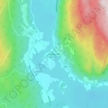
Name: Noresund topographic map, elevation, terrain.
Location: Noresund, Krødsherad, Buskerud, 3536, Norway (60.15986 9.60410 60.19986 9.64410)
Average elevation: 256 m
Minimum elevation: 119 m
Maximum elevation: 665 m