Geolocate

Ghandruk topographic map

Click on the map to display elevation.

About this map

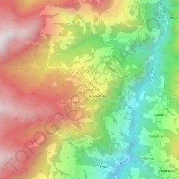
Name: Ghandruk topographic map, elevation, terrain.

Location: Ghandruk, Annapurna, Kaski, Gandaki Province, Nepal (28.35687 83.78779 28.39687 83.82779)

Average elevation: 1,897 m

Minimum elevation: 1,239 m

Maximum elevation: 2,583 m

Other topographic maps

Click on a map to view its topography, its elevation and its terrain.

Annapurna

Nepal > Gandaki Province > Kaski

Average elevation: 2,974 m

Gear up for your next adventure:

📷Outdoor Action Camera - Capture high-elevation views and rugged adventures
🧰Multitool Knife - Compact and versatile tool for outdoor use
Camping Tent - Weather-resistant tents suitable for 2 to 6 people
🔦LED Headlamp - Hands-free lighting for early morning starts or late finishes
🧴Waterproofing Spray - Restore the DWR coating on jackets and tents

As an Amazon Associate, this site earns from qualifying purchases at no extra cost to you.