Geolocate

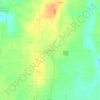
Merom topographic map

Click on the map to display elevation.

About this map

Name: Merom topographic map, elevation, terrain.

Location: Merom, Sullivan County, Indiana, United States (39.04965 -87.57245 39.06258 -87.56257)

Average elevation: 149 m

Minimum elevation: 126 m

Maximum elevation: 184 m

Other topographic maps

Click on a map to view its topography, its elevation and its terrain.
Bucktown

United States > Indiana > Sullivan County

Average elevation: 167 m

Fairbanks

United States > Indiana > Sullivan County

Average elevation: 164 m

Gear up for your next adventure:

🚲Bike Repair Kit - Essential tools for on-trail mechanical issues
🐕Hiking Dog Pack - Let your canine companion carry their own water and food
🏕️Camping Hammock - Integrated protection for sleeping between trees
🧊Portable Cooler - Keep food and drinks cold during outdoor adventures
🧴Bear Spray Holster - Quick-access carry for essential Canadian wilderness safety

As an Amazon Associate, this site earns from qualifying purchases at no extra cost to you.