
Sterksel topographic map
Interactive map
Click on the map to display elevation.
About this map
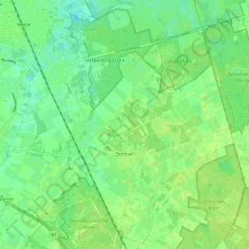
Name: Sterksel topographic map, elevation, terrain.
Location: Sterksel, Heeze-Leende, Noord-Brabant, Nederland (51.32754 5.58860 51.38917 5.65471)
Average elevation: 26 m
Minimum elevation: 18 m
Maximum elevation: 31 m
Other topographic maps
Click on a map to view its topography, its elevation and its terrain.
Herbertusbossen
Nederland > Noord-Brabant > Sterksel
Herbertusbossen, Ten Brakeweg, Kloostervelden, Sterksel, Heeze-Leende, Noord-Brabant, Nederland, 6029 TA, Nederland
Average elevation: 24 m