Geolocate

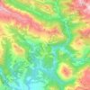
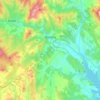
Puyarruego topographic map

Click on the map to display elevation.

About this map

Name: Puyarruego topographic map, elevation, terrain.

Location: Puyarruego, Puértolas, Sobrarbe, Huesca, Aragón, 22363, España (42.48715 0.10661 42.52715 0.14661)

Average elevation: 734 m

Minimum elevation: 585 m

Maximum elevation: 1,153 m

Other topographic maps

Click on a map to view its topography, its elevation and its terrain.
Boltaña

España > Aragón > Sobrarbe

Average elevation: 859 m

Tella-Sin

España > Aragón > Sobrarbe

Average elevation: 1,448 m

La Fueva

España > Aragón > Sobrarbe

Average elevation: 923 m

Embalse de Mediano

España > Aragón > Sobrarbe

Average elevation: 649 m

Cañón de Añisclo

España > Aragón > Sobrarbe

Average elevation: 1,487 m

Gear up for your next adventure:

🥾Light Hiking Boots - Lightweight and comfortable boots for day hikes
👟Sport Hiking Sandals - Breathable footwear for water crossings and camp rest
🧶550 Survival Paracord - Versatile utility cord for emergency repairs and rigging
🥾Trail Running Boots - Durable shoes designed for trail running
🪑Insulated Seat Pad - Protect your seat from cold rocks and wet logs

As an Amazon Associate, this site earns from qualifying purchases at no extra cost to you.