Geolocate

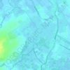
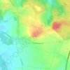
Mametz topographic map

Click on the map to display elevation.

About this map

Name: Mametz topographic map, elevation, terrain.

Location: Mametz, Saint-Omer, Pas-de-Calais, Hauts-de-France, Metropolitan France, 62120, France (50.60956 2.27429 50.64474 2.34014)

Average elevation: 41 m

Minimum elevation: 18 m

Maximum elevation: 106 m

Other topographic maps

Click on a map to view its topography, its elevation and its terrain.

Panehem

France > Hauts-de-France > Pas-de-Calais > Samer

Average elevation: 70 m

Le Petit Vimy

France > Hauts-de-France > Pas-de-Calais > Vimy

Average elevation: 93 m

Noyelles

France > Hauts-de-France > Pas-de-Calais > Bours

Average elevation: 125 m

Gear up for your next adventure:

💡Compact LED Flashlight - Powerful and portable flashlight for outdoor use
🥾Trail Hiking Socks - Comfortable socks to prevent blisters and fatigue
🥾Trail Hiking Shoes - Durable shoes designed for rugged trails
🥾Waterproof Hiking Boots - Boots keeping your feet dry in wet conditions
🧭GPS Handheld Device - Reliable GPS navigation for outdoor adventures

As an Amazon Associate, this site earns from qualifying purchases at no extra cost to you.