Geolocate

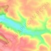
Ustechko topographic map

Click on the map to display elevation.

About this map

Name: Ustechko topographic map, elevation, terrain.

Location: Ustechko, Tovste Settlement Hromada, Chortkiv Raion, Ternopil Oblast, 48634, Ukraine (48.75055 25.58605 48.78614 25.64121)

Average elevation: 249 m

Minimum elevation: 151 m

Maximum elevation: 325 m

Other topographic maps

Click on a map to view its topography, its elevation and its terrain.
Hodiv

Ukraine > Ternopil Oblast

Average elevation: 371 m

Gear up for your next adventure:

💡Solar Camping Lamp - Eco-friendly lighting for campsites
🛏️Camping Sleeping Mat - Comfortable mats for sleeping outdoors
🚲Bike Repair Kit - Essential tools for on-trail mechanical issues
🧢Outdoor Cap - Protective cap for sun and rain during hikes
🐕Hiking Dog Pack - Let your canine companion carry their own water and food

As an Amazon Associate, this site earns from qualifying purchases at no extra cost to you.