Geolocate

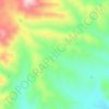
Duncan topographic map

Click on the map to display elevation.

About this map

Name: Duncan topographic map, elevation, terrain.

Location: Duncan, Greenlee County, Arizona, United States (32.70546 -109.11462 32.76269 -109.07694)

Average elevation: 1,140 m

Minimum elevation: 1,102 m

Maximum elevation: 1,213 m

Other topographic maps

Click on a map to view its topography, its elevation and its terrain.

Morenci

United States > Arizona > Greenlee County

Average elevation: 1,246 m

Benton Tank

United States > Arizona > Greenlee County

Average elevation: 1,701 m

Cleaveland

United States > Arizona > Greenlee County

Average elevation: 2,399 m

Limestone Spring

United States > Arizona > Greenlee County > Morenci

Average elevation: 1,333 m

Gear up for your next adventure:

🎒Hiking Daypack - Lightweight and durable backpacks for day trips and excursions
🔦LED Headtorch - Bright and durable light for night activities
🚲MTB Frame Bag - Carry tools and maps directly on your bicycle frame
🥽Outdoor Goggles - Protective eyewear for outdoor activities
🧥Fleece Jacket - Warm and lightweight jacket for layering

As an Amazon Associate, this site earns from qualifying purchases at no extra cost to you.