Geolocate

Imphal topographic map

Click on the map to display elevation.

About this map
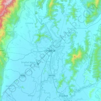
Name: Imphal topographic map, elevation, terrain.

Location: Imphal, Imphal West, Manipur, 795001, India (24.63912 93.77644 24.95912 94.09644)

Average elevation: 861 m

Minimum elevation: 767 m

Maximum elevation: 2,308 m

Other topographic maps

Click on a map to view its topography, its elevation and its terrain.

Thoubal River

India > Manipur > Saikul

Average elevation: 1,013 m

Uchiwa

India > Manipur > Wangoi > Uchiwa

Average elevation: 771 m

Gear up for your next adventure:

⛺Backpacking Tent - Lightweight tent for long-distance hiking trips
🛶Canoe Life Vest - Safety vest for water sports
🧥Fleece Jacket - Warm and lightweight jacket for layering
🔪Outdoor Multitool - Versatile tool for repairs and food prep in the wild
🧰Survival Kit - Essential gear for emergencies in the wilderness

As an Amazon Associate, this site earns from qualifying purchases at no extra cost to you.