Geolocate

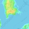
Fort Wetherill topographic map

Click on the map to display elevation.

About this map

Name: Fort Wetherill topographic map, elevation, terrain.

Location: Fort Wetherill, Jamestown, Newport County, Rhode Island, 02840, United States (41.47750 -71.35821 41.47760 -71.35811)

Average elevation: 4 m

Minimum elevation: -2 m

Maximum elevation: 30 m

Other topographic maps

Click on a map to view its topography, its elevation and its terrain.

Gear up for your next adventure:

☕Camping Coffee Maker - Brew fresh coffee anywhere on the topographic map
🧳Compression Sacks - Maximize space in your backpack by shrinking gear
🥾Trail Hiking Boots - Supportive boots for rough trails
🥾Trail Hiking Shoes - Durable shoes designed for rugged trails
⛺Lightweight Backpacking Tent - Compact tent for efficient hiking trips

As an Amazon Associate, this site earns from qualifying purchases at no extra cost to you.