Geolocate

Berryville topographic map

Click on the map to display elevation.

About this map

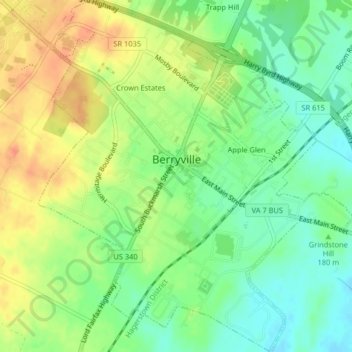
Name: Berryville topographic map, elevation, terrain.

Location: Berryville, Clarke County, Virginia, 22611, United States (39.13448 -77.99855 39.16599 -77.96203)

Average elevation: 182 m

Minimum elevation: 160 m

Maximum elevation: 208 m

Other topographic maps

Click on a map to view its topography, its elevation and its terrain.

Gear up for your next adventure:

🥾Mountain Hiking Boots - High-traction boots for rocky terrain
🥾Mountain Hiking Shoes - Shoes with superior grip for mountainous terrain
Backpacking Tent - Lightweight tent for long-distance hiking trips
🧴Sunscreen SPF - Broad-spectrum sunscreen for outdoor activities
🛌Insulated Sleeping Pad - Critical thermal barrier between you and the cold ground

As an Amazon Associate, this site earns from qualifying purchases at no extra cost to you.