Geolocate

Jánovas topographic map

Click on the map to display elevation.

About this map
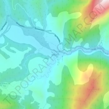
Name: Jánovas topographic map, elevation, terrain.

Location: Jánovas, Fiscal, Sobrarbe, Huesca, Aragón, 22347, España (42.44532 -0.02295 42.48532 0.01705)

Average elevation: 866 m

Minimum elevation: 631 m

Maximum elevation: 1,626 m

Gear up for your next adventure:

💧Hydration Bladder - Hands-free hydration solution for long treks
💧Collapsible Water Bottle - Space-saving water bottle for outdoor activities
👟Trail Running Shoes - Agile footwear for fast-paced topographic exploration
🥾Mountain Hiking Boots - High-traction boots for rocky terrain
🧢Hiking Sun Hat - Wide-brimmed protection for exposed mountain ridges

As an Amazon Associate, this site earns from qualifying purchases at no extra cost to you.