
Make a donation
Gear up for your next adventure:
As an Amazon Associate, this site earns from qualifying purchases at no extra cost to you.
Godeffroy topographic map
Click on the map to display elevation.
Make a donation
Gear up for your next adventure:
As an Amazon Associate, this site earns from qualifying purchases at no extra cost to you.
About this map
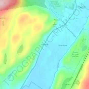
Name: Godeffroy topographic map, elevation, terrain.
Average elevation: 215 m
Minimum elevation: 135 m
Maximum elevation: 402 m
Make a donation
Gear up for your next adventure:
As an Amazon Associate, this site earns from qualifying purchases at no extra cost to you.
Other topographic maps
Click on a map to view its topography, its elevation and its terrain.
Harriman State Park
United States > New York > Orange County > Town of Tuxedo
Average elevation: 219 m
Make a donation
Gear up for your next adventure:
As an Amazon Associate, this site earns from qualifying purchases at no extra cost to you.
Village of Florida
United States > New York > Orange County > Town of Warwick
Average elevation: 150 m
Storm King State Park
United States > New York > Orange County > Town of Cornwall > Village of Cornwall-on-Hudson
Average elevation: 195 m
Make a donation
Gear up for your next adventure:
As an Amazon Associate, this site earns from qualifying purchases at no extra cost to you.
Village of Warwick
United States > New York > Orange County > Town of Warwick
Average elevation: 187 m
Make a donation
Gear up for your next adventure:
As an Amazon Associate, this site earns from qualifying purchases at no extra cost to you.
Schunnemunk State Park
United States > New York > Orange County > Village of Woodbury
Average elevation: 213 m
Make a donation
Gear up for your next adventure:
As an Amazon Associate, this site earns from qualifying purchases at no extra cost to you.
Village of Montgomery
United States > New York > Orange County
These lands in the west are the lowest-lying in the village. Much of its topography rises gently from the river, with little relief save the Academy Hill area on the east edge of downtown where the village hall is located, and a 455-foot (139 m) hill at the junction of Purple Martin Road and Cardinal Drive…
Average elevation: 118 m
Appalachian National Scenic Trail
United States > New York > Orange County > Village of Greenwood Lake
Plant life along the trail is varied. The trail passes through several different biomes from south to north, and the climate changes significantly, particularly dependent upon elevation. In the south, lowland forests consist mainly of second-growth; nearly the entire trail has been logged at one time or…
Average elevation: 274 m
Make a donation
Gear up for your next adventure:
As an Amazon Associate, this site earns from qualifying purchases at no extra cost to you.
Make a donation
Gear up for your next adventure:
As an Amazon Associate, this site earns from qualifying purchases at no extra cost to you.