Geolocate

Grant topographic map

Click on the map to display elevation.

About this map

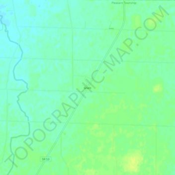
Name: Grant topographic map, elevation, terrain.

Location: Grant, Pleasant Township, Hardin County, Ohio, United States (40.69061 -83.58798 40.73061 -83.54798)

Average elevation: 284 m

Minimum elevation: 277 m

Maximum elevation: 293 m

Other topographic maps

Click on a map to view its topography, its elevation and its terrain.

Ada

United States > Ohio > Hardin County

Average elevation: 293 m

Alger

United States > Ohio > Hardin County

Average elevation: 304 m

Dunkirk

United States > Ohio > Hardin County

Average elevation: 287 m

Forest

United States > Ohio > Hardin County

Average elevation: 283 m

McGuffey

United States > Ohio > Hardin County

Average elevation: 296 m

Mount Victory

United States > Ohio > Hardin County

Average elevation: 317 m

Patterson

United States > Ohio > Hardin County

Average elevation: 281 m

Ridgeway

United States > Ohio > Hardin County

Average elevation: 323 m

Buck Township

United States > Ohio > Hardin County

Average elevation: 303 m

Gear up for your next adventure:

🥾Hiking Gaiters - Protect legs and shoes from mud, snow, and debris
Camping Essentials - All-in-one gear for a comfortable camping trip
💧Reusable Water Bottle - Durable water bottles for hydration on trails
🧢Beanie Hat - Keep your head warm in cold weather
🥾All-Terrain Hiking Boots - Versatile boots for varied hiking conditions

As an Amazon Associate, this site earns from qualifying purchases at no extra cost to you.