
Make a donation
Gear up for your next adventure:
As an Amazon Associate, this site earns from qualifying purchases at no extra cost to you.
West Liberty topographic map
Click on the map to display elevation.
Make a donation
Gear up for your next adventure:
As an Amazon Associate, this site earns from qualifying purchases at no extra cost to you.
About this map
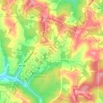
Name: West Liberty topographic map, elevation, terrain.
Location: West Liberty, Ohio County, West Virginia, United States (40.15892 -80.61269 40.17702 -80.57595)
Average elevation: 354 m
Minimum elevation: 280 m
Maximum elevation: 412 m
Make a donation
Gear up for your next adventure:
As an Amazon Associate, this site earns from qualifying purchases at no extra cost to you.
Other topographic maps
Click on a map to view its topography, its elevation and its terrain.
Pleasant Valley
United States > West Virginia > Ohio County > Wheeling > Pleasant Valley
Average elevation: 284 m
Make a donation
Gear up for your next adventure:
As an Amazon Associate, this site earns from qualifying purchases at no extra cost to you.