
Thank you for supporting this site ❤️
Make a donation
Make a donation
Gear up for your next adventure:
As an Amazon Associate, this site earns from qualifying purchases at no extra cost to you.
Chinguri topographic map
Click on the map to display elevation.
Thank you for supporting this site ❤️
Make a donation
Make a donation
Gear up for your next adventure:
As an Amazon Associate, this site earns from qualifying purchases at no extra cost to you.
About this map
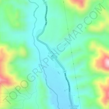
Name: Chinguri topographic map, elevation, terrain.
Location: Chinguri, Municipio Aiquile, Campero, Cochabamba, Bolivia (-18.38796 -65.22625 -18.38086 -65.21969)
Average elevation: 2,042 m
Minimum elevation: 1,944 m
Maximum elevation: 2,277 m
Thank you for supporting this site ❤️
Make a donation
Make a donation
Gear up for your next adventure:
As an Amazon Associate, this site earns from qualifying purchases at no extra cost to you.