
Antras topographic map
Interactive map
Click on the map to display elevation.
About this map
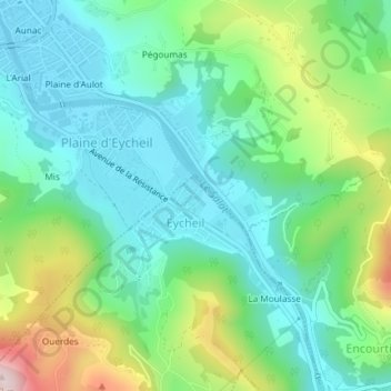
Name: Antras topographic map, elevation, terrain.
Average elevation: 501 m
Minimum elevation: 392 m
Maximum elevation: 773 m
Other topographic maps
Click on a map to view its topography, its elevation and its terrain.
Col de Jou
Col de Jou, Eycheil, Saint-Girons, Ariège, Occitanie, France métropolitaine, 09200, France
Average elevation: 547 m