Geolocate

Dhayari topographic map

Click on the map to display elevation.

About this map

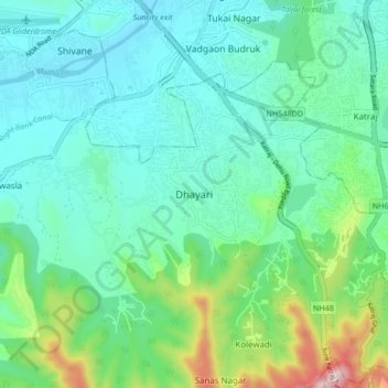
Name: Dhayari topographic map, elevation, terrain.

Location: Dhayari, Haveli, Pune, Maharashtra, 411041, India (18.39740 73.77904 18.47740 73.85904)

Average elevation: 676 m

Minimum elevation: 547 m

Maximum elevation: 1,142 m

Gear up for your next adventure:

🧣Evaporative Cooling Towel - Beat the heat during intense summer climbs
🧥Softshell Hiking Jacket - The perfect balance of wind protection and breathability
🥾Approach Boots - Comfortable boots for hiking and climbing approaches
Backpacking Tent - Lightweight tent for long-distance hiking trips
🔨Vehicle Emergency Tool - Safety tool for remote road trips to trailheads

As an Amazon Associate, this site earns from qualifying purchases at no extra cost to you.