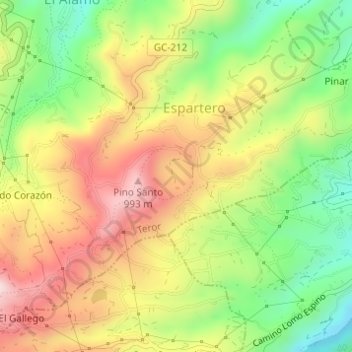
Caldera de Pino Santo topographic map
Interactive map
Click on the map to display elevation.
About this map
Name: Caldera de Pino Santo topographic map, elevation, terrain.
Average elevation: 751 m
Minimum elevation: 543 m
Maximum elevation: 967 m

Click on the map to display elevation.
Name: Caldera de Pino Santo topographic map, elevation, terrain.
Average elevation: 751 m
Minimum elevation: 543 m
Maximum elevation: 967 m