Geolocate

Porbandar topographic map

Click on the map to display elevation.

Porbandar

Porbandar is located at 21°37′48″N 69°36′0″E / 21.63000°N 69.60000°E / 21.63000; 69.60000. It has an average elevation of 1 metre (3 ft).

Wikipedia (CC-BY-SA 3.0)

About this map

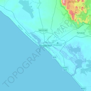
Name: Porbandar topographic map, elevation, terrain.

Location: Porbandar, Porbandar Taluka, Porbandar District, Gujarat, 360500, India (21.48090 69.45100 21.80090 69.77100)

Average elevation: 18 m

Minimum elevation: -1 m

Maximum elevation: 386 m

Gear up for your next adventure:

🧰Multitool Knife - Compact and versatile tool for outdoor use
🧴Outdoor Sunscreen - High SPF protection for high-altitude UV exposure
🧰Emergency Multi-Tool - Compact multi-tool for outdoor survival
🔭Compact Binoculars - Lightweight optics for scouting trails and wildlife
🔥Emergency Fire Starter - Reliable ignition source for all weather conditions

As an Amazon Associate, this site earns from qualifying purchases at no extra cost to you.