Geolocate

Serrapio topographic map

Click on the map to display elevation.

About this map

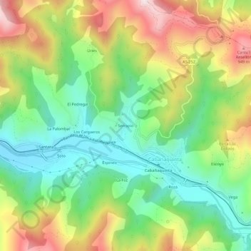
Name: Serrapio topographic map, elevation, terrain.

Location: Serrapio, Cabañaquinta, Aller, Asturias, 33686, España (43.14709 -5.65205 43.18709 -5.61205)

Average elevation: 629 m

Minimum elevation: 377 m

Maximum elevation: 1,006 m

Gear up for your next adventure:

🥾Waterproof Hiking Boots - Essential footwear for rugged terrain and wet Canadian trails
🧭Orienteering Kit - Tools for map reading and navigation in the wild
🧳Compression Sacks - Maximize space in your backpack by shrinking gear
🥾Hiking Shoes - Durable and comfortable shoes for trail hiking
🦶Anti-Blister Balm - Prevents friction and hotspots during long ascents

As an Amazon Associate, this site earns from qualifying purchases at no extra cost to you.