
Khasa topographic map
Interactive map
Click on the map to display elevation.
About this map
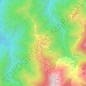
Name: Khasa topographic map, elevation, terrain.
Location: Khasa, Pangchao SDO, Longding, Arunachal Pradesh, India (26.69699 95.33829 26.73699 95.37829)
Average elevation: 1,201 m
Minimum elevation: 782 m
Maximum elevation: 1,820 m