
Make a donation
Gear up for your next adventure:
As an Amazon Associate, this site earns from qualifying purchases at no extra cost to you.
Lewisberry topographic map
Click on the map to display elevation.
Make a donation
Gear up for your next adventure:
As an Amazon Associate, this site earns from qualifying purchases at no extra cost to you.
About this map
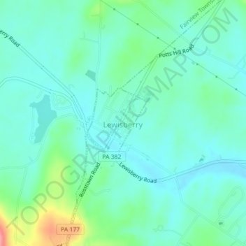
Name: Lewisberry topographic map, elevation, terrain.
Location: Lewisberry, York County, Pennsylvania, United States (40.13132 -76.86486 40.13911 -76.85625)
Average elevation: 143 m
Minimum elevation: 122 m
Maximum elevation: 215 m
Make a donation
Gear up for your next adventure:
As an Amazon Associate, this site earns from qualifying purchases at no extra cost to you.
Other topographic maps
Click on a map to view its topography, its elevation and its terrain.
Airville
United States > Pennsylvania > York County > Lower Chanceford Township > Airville
Average elevation: 209 m
Remeos Mobile Home Park
United States > Pennsylvania > York County > Fairview Township
Average elevation: 133 m
Make a donation
Gear up for your next adventure:
As an Amazon Associate, this site earns from qualifying purchases at no extra cost to you.