
Thị xã Sông Cầu topographic map
Interactive map
Click on the map to display elevation.
About this map
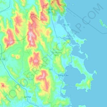
Name: Thị xã Sông Cầu topographic map, elevation, terrain.
Location: Thị xã Sông Cầu, Province de Phú Yên, Viêt Nam (13.35908 109.09176 13.69515 109.33112)
Average elevation: 137 m
Minimum elevation: -1 m
Maximum elevation: 859 m
Other topographic maps
Click on a map to view its topography, its elevation and its terrain.
Sông Cầu
Viêt Nam > Province de Phú Yên > Sông Cầu
Sông Cầu, Thị xã Sông Cầu, Province de Phú Yên, Viêt Nam
Average elevation: 59 m