Geolocate

Castrovalva topographic map

Click on the map to display elevation.

About this map

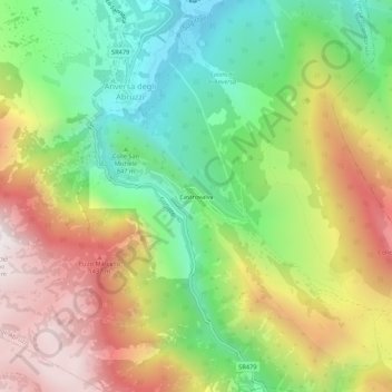
Name: Castrovalva topographic map, elevation, terrain.

Location: Castrovalva, Anversa degli Abruzzi, L'Aquila, Abruzzo, Italy (41.96327 13.79317 42.00327 13.83317)

Average elevation: 994 m

Minimum elevation: 468 m

Maximum elevation: 1,659 m

Gear up for your next adventure:

🥾Mountaineering Boots - Supportive boots for climbing and high-altitude hiking
🧦Hiking Liner Socks - Thin base layer to prevent friction and blisters
🛰️Satellite Messenger - Emergency communication for areas with no cell service
💡Portable Camping Lamp - Rechargeable lamp for campsite lighting
💡LED Headlamp - Hands-free illumination for night hiking and camping

As an Amazon Associate, this site earns from qualifying purchases at no extra cost to you.