Geolocate

Cuckfield topographic map

Click on the map to display elevation.

About this map

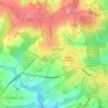
Name: Cuckfield topographic map, elevation, terrain.

Location: Cuckfield, Mid Sussex, West Sussex, England, United Kingdom (50.99183 -0.15566 51.01914 -0.11911)

Average elevation: 87 m

Minimum elevation: 42 m

Maximum elevation: 129 m

Gear up for your next adventure:

🚲Bike Repair Kit - Essential tools for on-trail mechanical issues
🥾Trail Hiking Socks - Comfortable socks to prevent blisters and fatigue
💧Hydration Pack - Hands-free hydration system for long hikes
🥾Hiking Shorts - Breathable shorts suitable for summer hikes
🧢Outdoor Visor - Breathable visor for sunny hikes

As an Amazon Associate, this site earns from qualifying purchases at no extra cost to you.