Geolocate

Cereixido topographic map

Click on the map to display elevation.

About this map

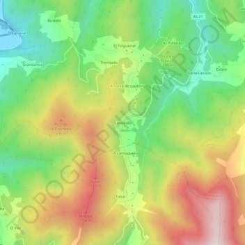
Name: Cereixido topographic map, elevation, terrain.

Location: Cereixido, Vegadeo, Asturias, 33779, España (43.41014 -7.08357 43.45014 -7.04357)

Average elevation: 302 m

Minimum elevation: -2 m

Maximum elevation: 685 m

Gear up for your next adventure:

👟Leg Gaiters - Keep debris, mud, and snow out of your boots
🧥Insulated Jacket - Keep warm in cold outdoor conditions
🧭GPS Tracker - Track your location in remote areas safely
🔋Solar Power Bank - Keep your GPS and devices charged during long outdoor trips
🧤Thermal Hiking Gloves - Grip-enhanced gloves for cold-weather altitude trekking

As an Amazon Associate, this site earns from qualifying purchases at no extra cost to you.