Geolocate

Malaya topographic map

Click on the map to display elevation.

About this map

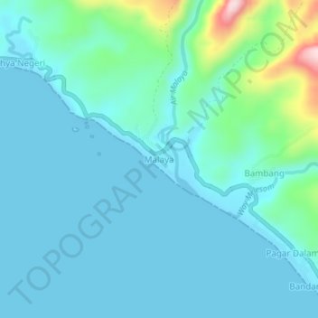
Name: Malaya topographic map, elevation, terrain.

Location: Malaya, Pesisir Barat, Lampung, Sumatra, Indonesia (-4.99357 103.70587 -4.95357 103.74587)

Average elevation: 45 m

Minimum elevation: 0 m

Maximum elevation: 301 m

Other topographic maps

Click on a map to view its topography, its elevation and its terrain.

Gear up for your next adventure:

🔪Outdoor Multitool - Versatile tool for repairs and food prep in the wild
🛁Quick-Dry Microfiber Towel - Space-saving towel that dries rapidly on the move
🥘Camping Cookware Set - Compact nesting pots and pans for trail cooking
🥾Trail Hiking Shoes - Durable shoes designed for rugged trails
🛶Kayak Dry Bag - Waterproof storage for kayaking adventures

As an Amazon Associate, this site earns from qualifying purchases at no extra cost to you.