Geolocate

Soumaa topographic map

Click on the map to display elevation.

About this map

Name: Soumaa topographic map, elevation, terrain.

Location: Soumaa, Boufarik District, Blida, 09000, Algeria (36.46107 2.88917 36.55284 2.95250)

Average elevation: 362 m

Minimum elevation: 57 m

Maximum elevation: 1,450 m

Other topographic maps

Click on a map to view its topography, its elevation and its terrain.
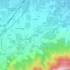
Soumaa

Algeria > Blida > Boufarik District > Soumaa > Soumaa

Average elevation: 239 m

Gear up for your next adventure:

🧭GPS Handheld Device - Reliable GPS navigation for outdoor adventures
🕶️Polarized Sunglasses - Reduces glare from snow and water at high elevations
🧦Outdoor Socks - Durable socks designed for hiking and outdoor sports
🧭GPS Tracker - Track your location in remote areas safely
🥾Trail Running Shoes - Lightweight and durable shoes for trail running

As an Amazon Associate, this site earns from qualifying purchases at no extra cost to you.