Geolocate

Goela topographic map

Click on the map to display elevation.

About this map

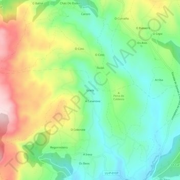
Name: Goela topographic map, elevation, terrain.

Location: Goela, Fanoi, Abadín, Terra Chá, Lugo, Galicia, 27730, Spain (43.37023 -7.50550 43.41023 -7.46550)

Average elevation: 599 m

Minimum elevation: 475 m

Maximum elevation: 800 m

Gear up for your next adventure:

📷Outdoor Action Camera - Capture high-elevation views and rugged adventures
🥾Waterproof Hiking Boots - Essential footwear for rugged terrain and wet Canadian trails
🧦Thermal Socks - Warm socks for winter hiking or camping
🥽Outdoor Goggles - Protective eyewear for outdoor activities
🧥Softshell Jacket - Windproof and breathable jacket for hiking

As an Amazon Associate, this site earns from qualifying purchases at no extra cost to you.