Geolocate

Saint-Colomban topographic map

Click on the map to display elevation.

About this map
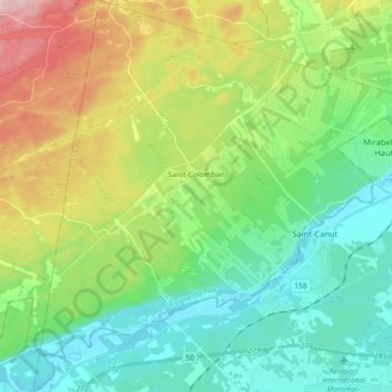
Name: Saint-Colomban topographic map, elevation, terrain.

Location: Saint-Colomban, La Rivière-du-Nord, Laurentides, Quebec, Canada (45.67083 -74.21203 45.79503 -74.03902)

Average elevation: 150 m

Minimum elevation: 59 m

Maximum elevation: 352 m

La Rivière-du-Nord trails, hiking, mountain biking, running and outdoor activities

Other topographic maps

Click on a map to view its topography, its elevation and its terrain.

Gear up for your next adventure:

🔋Emergency Crank Radio - Weather alerts and power without needing batteries
🔦UV Flashlight - Detect minerals or specific insects in the dark
🍽️Titanium Camping Spork - Ultralight and indestructible eating utensil
🥾Waterproof Hiking Boots - Boots keeping your feet dry in wet conditions
🥫Freeze-Dried Meals - Lightweight, high-calorie nutrition for multi-day treks

As an Amazon Associate, this site earns from qualifying purchases at no extra cost to you.