Geolocate

Restrepo topographic map

Click on the map to display elevation.

About this map

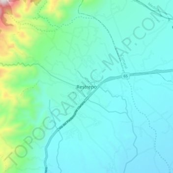
Name: Restrepo topographic map, elevation, terrain.

Location: Restrepo, Piedemonte, Meta, Colombia (4.22159 -73.60304 4.30159 -73.52304)

Average elevation: 553 m

Minimum elevation: 389 m

Maximum elevation: 1,412 m

Gear up for your next adventure:

🧦Hiking Liner Socks - Thin base layer to prevent friction and blisters
🧴Outdoor Sunscreen - High SPF protection for high-altitude UV exposure
🛌Down Sleeping Bag - Superior warmth-to-weight ratio for cold nights
🧥Packable Rain Jacket - Breathable waterproof layer for unpredictable weather
👖Convertible Hiking Pants - Zip-off legs to adapt to changing weather conditions

As an Amazon Associate, this site earns from qualifying purchases at no extra cost to you.