Geolocate

Sidi Slimane topographic map

Click on the map to display elevation.

About this map
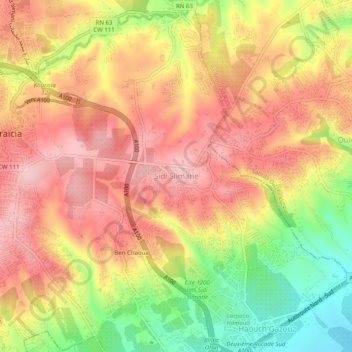
Name: Sidi Slimane topographic map, elevation, terrain.

Location: Sidi Slimane, Draria District, Algiers, 16000, Algeria (36.65237 2.98608 36.69237 3.02608)

Average elevation: 138 m

Minimum elevation: 30 m

Maximum elevation: 209 m

Other topographic maps

Click on a map to view its topography, its elevation and its terrain.
Draria

Algeria > Algiers > Draria District

Average elevation: 169 m

Gear up for your next adventure:

🔨Vehicle Emergency Tool - Safety tool for remote road trips to trailheads
🧭GPS Outdoor Watch - Smart watch for navigation and fitness tracking in nature
⛺Tent Footprint - Protect tent floor and increase durability
🧢Outdoor Cap - Protective cap for sun and rain during hikes
💧Filtered Water Bottle - Safe drinking water on the go

As an Amazon Associate, this site earns from qualifying purchases at no extra cost to you.