Geolocate

Liebenau topographic map

Click on the map to display elevation.

About this map
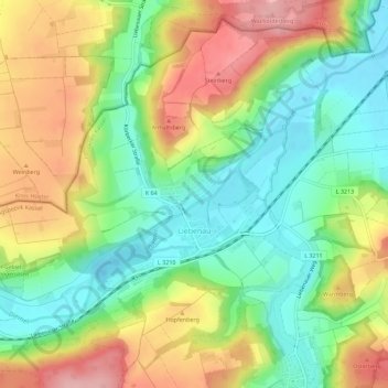
Name: Liebenau topographic map, elevation, terrain.

Location: Liebenau, Landkreis Kassel, Hessen, Duitsland (51.48358 9.26303 51.51542 9.31949)

Average elevation: 203 m

Minimum elevation: 137 m

Maximum elevation: 290 m

Gear up for your next adventure:

❄️Traction Ice Cleats - Slip-on spikes for icy trails and winter hiking
🧰Multitool Knife - Compact and versatile tool for outdoor use
🥾Trail Hiking Shoes - Durable shoes designed for rugged trails
🧣Evaporative Cooling Towel - Beat the heat during intense summer climbs
🥾Mountaineering Boots - Supportive boots for climbing and high-altitude hiking

As an Amazon Associate, this site earns from qualifying purchases at no extra cost to you.