Geolocate

Taragoña topographic map

Click on the map to display elevation.

About this map

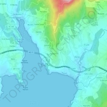
Name: Taragoña topographic map, elevation, terrain.

Location: Taragoña, Rianxo, Barbanza, La Coruña, Galicia, 15985, España (42.65401 -8.84576 42.69401 -8.80576)

Average elevation: 35 m

Minimum elevation: 0 m

Maximum elevation: 243 m

Gear up for your next adventure:

🥾Hiking Leggings - Comfortable leggings for outdoor activities
🧦Hiking Socks - Moisture-wicking and comfortable socks for long hikes
💧Reusable Water Bottle - Durable water bottles for hydration on trails
🧭GPS Handheld Device - Reliable GPS navigation for outdoor adventures
🚲MTB Frame Bag - Carry tools and maps directly on your bicycle frame

As an Amazon Associate, this site earns from qualifying purchases at no extra cost to you.