Geolocate

Kaidi topographic map

Click on the map to display elevation.

About this map
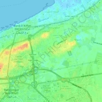
Name: Kaidi topographic map, elevation, terrain.

Location: Kaidi, Burj Al Kifan, Dar el-Beida District, Algiers, 16000, Algeria (36.71849 3.18496 36.75849 3.22496)

Average elevation: 13 m

Minimum elevation: -2 m

Maximum elevation: 35 m

Other topographic maps

Click on a map to view its topography, its elevation and its terrain.

Gear up for your next adventure:

🧴Outdoor Sunscreen - High SPF protection for high-altitude UV exposure
🚲Bike Repair Kit - Essential tools for on-trail mechanical issues
🦯Trekking Poles - Reduced impact on joints for steep topographic climbs
🧤Rechargeable Heated Gloves - Extreme warmth for Canadian winter expeditions
🧳Compression Sacks - Maximize space in your backpack by shrinking gear

As an Amazon Associate, this site earns from qualifying purchases at no extra cost to you.