Geolocate

Sahastradhara topographic map

Click on the map to display elevation.

About this map

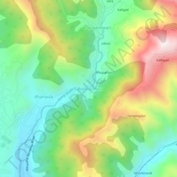
Name: Sahastradhara topographic map, elevation, terrain.

Location: Sahastradhara, Dehradun, Uttarakhand, 248013, India (30.36531 78.10983 30.40531 78.14983)

Average elevation: 1,100 m

Minimum elevation: 757 m

Maximum elevation: 1,680 m

Gear up for your next adventure:

🧥Packable Rain Jacket - Breathable waterproof layer for unpredictable weather
Lightweight Camping Tent - Portable shelter optimized for Canadian backcountry camping
🚲MTB Frame Bag - Carry tools and maps directly on your bicycle frame
🚲Handlebar Phone Mount - View topographic-map.com live while cycling
🧢Sun Protection Cap - Breathable cap to protect from sun exposure

As an Amazon Associate, this site earns from qualifying purchases at no extra cost to you.