
Lake Colorado City State Park topographic map
Interactive map
Click on the map to display elevation.
About this map
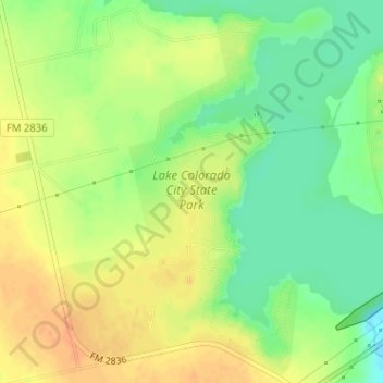
Name: Lake Colorado City State Park topographic map, elevation, terrain.
Average elevation: 636 m
Minimum elevation: 617 m
Maximum elevation: 652 m
Other topographic maps
Click on a map to view its topography, its elevation and its terrain.
Colorado City
United States > Texas > Mitchell County
Colorado City, Mitchell County, Texas, 79512, United States
Average elevation: 649 m
Colorado City
United States > Texas > Mitchell County
Colorado City, Mitchell County, Texas, 79512, United States
Average elevation: 649 m